Sorties OpenDroneMap
Vous trouverez ci-dessous quelques-uns des résultats utiles produits par ODM.
Nuage de points
odm_georeferencing/odm_georeferenced_model.ply/laz/csv – Le nuage de points géoréférencé dans différents formats de fichiers
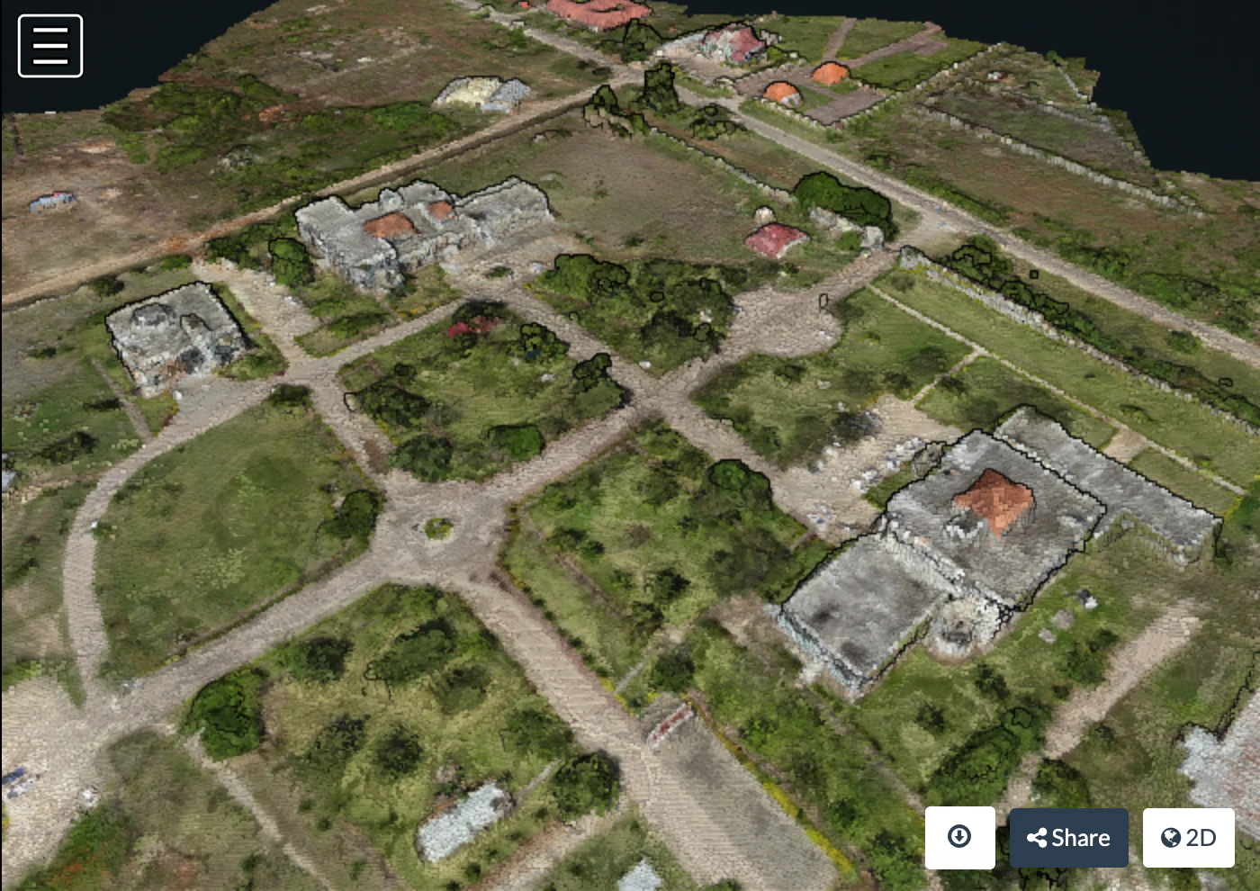
Nuage de points au-dessus de l’Université d’État de Zanzibar, avec l’aimable autorisation de Khadija Abdullah Ali
Modèle texturé 3D
odm_texturing/odm_textured_model.obj – Le maillage de surface texturé odm_texturing/odm_textured_model_geo.obj – Le maillage de surface géoréférencé et texturé
You can access the point cloud and textured meshes using MeshLab. Open MeshLab, and choose File:Import Mesh and choose your textured mesh from a location similar to the following: odm_texturing\odm_textured_model.obj
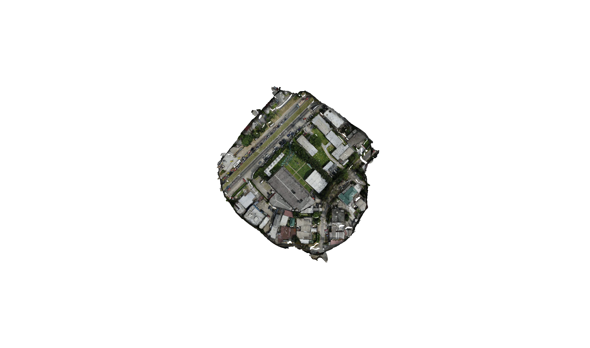
Maillage texturé avec l’aimable autorisation de OpenDroneMap
Orthophoto
odm_orthophoto/odm_orthphoto.tif – Orthophoto GeoTIFF. Vous pouvez l’utiliser dans QGIS en tant que couche raster.
odm_orthophoto/odm_orthphoto.original.tif – L’orthophoto dans son état d’origine non rogné.
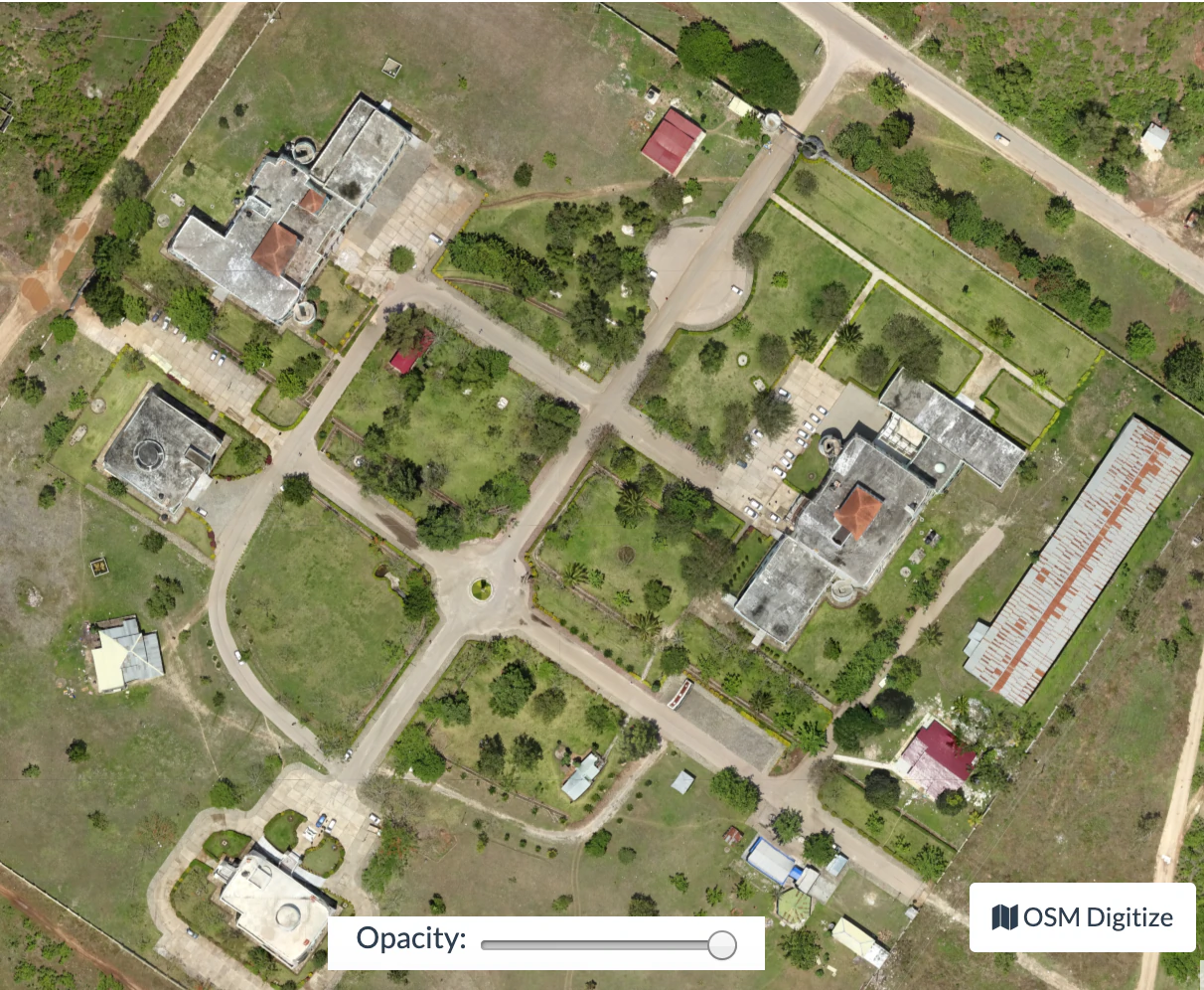
Orthophoto de l’Université d’État de Zanzibar, avec l’aimable autorisation de Khadija Abdullah Ali
DTM/DSM
DTM/DSM will only be created if the --dtm or --dsm options are used. See tutorial on elevation models for more options in creating.
Les données seront stockées dans:
odm_dem/dtm.tif
odm_dem/dsm.tif
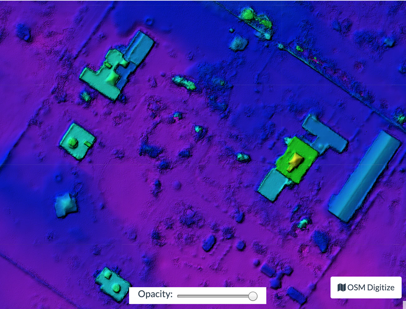
Modèle de surface numérique sur l’Université d’État de Zanzibar, avec l’aimable autorisation de Khadija Abdullah Ali
Logs
Logs are output to stdout. On Linux ANSI escape color code (eg ^[[39m) is used and could be disabled by setting no_ansiesc environment variable to any value like env no_ansiesc=1
Liste de toutes les sorties
project/
├── images/
│   ├── img-1234.jpg
│   └── ...
├── opensfm/                            # Tie Points and camera positions here in JSON format
│   ├── config.yaml
│   ├── images/
│   ├── masks/
│   ├── gcp_list.txt
│   ├── metadata/
│   ├── features/
│   ├── matches/
│   ├── tracks.csv
│   ├── reconstruction.json
│   ├── reconstruction.meshed.json
│   ├── undistorted/
│   ├── undistorted_tracks.json
│   ├── undistorted_reconstruction.json
│   └── depthmaps/
│      └── merged.ply                   # Dense Point Cloud
├── odm_meshing/
│   ├── odm_mesh.ply                    # A 3D mesh
│   └── odm_meshing_log.txt             # Output of the meshing task. May point out errors.
├── odm_texturing/
│   ├── odm_textured_model.obj          # Textured mesh
│   ├── odm_textured_model_geo.obj      # Georeferenced textured mesh
│   └── texture_N.jpg                   # Associated textured images used by the model
├── odm_georeferencing/
│   ├── odm_georeferenced_model.ply     # A georeferenced dense point cloud
│   ├── odm_georeferenced_model.laz # LAZ format point cloud
│   ├── odm_georeferenced_model.csv     # XYZ format point cloud
│   ├── odm_georeferencing_log.txt      # Georeferencing log
│   └── odm_georeferencing_utm_log.txt  # Log for the extract_utm portion
├── odm_orthophoto/
│   ├── odm_orthophoto.webp              # Orthophoto image (no coordinates)
│   ├── odm_orthophoto.tif              # Orthophoto GeoTiff
│   ├── odm_orthophoto_log.txt          # Log file
│   └── gdal_translate_log.txt          # Log for georeferencing the png file
└── odm_dem/
    ├── dsm.tif                     # Digital Surface Model Geotiff - the tops of everything
    └── dtm.tif                     # Digital Terrain Model Geotiff - the ground.
Apprenez à éditer et aidez à améliorer cette page!