مخرجات OpenDroneMap
فيما يلي بعض المخرجات المفيدة التي تنتجها ODM.
سحابة نقطة
odm_georeferencing/odm_georeferenced_model.ply/laz/csv`` -- سحابة مرجعية جغرافية في تنسيقات ملفات مختلفة
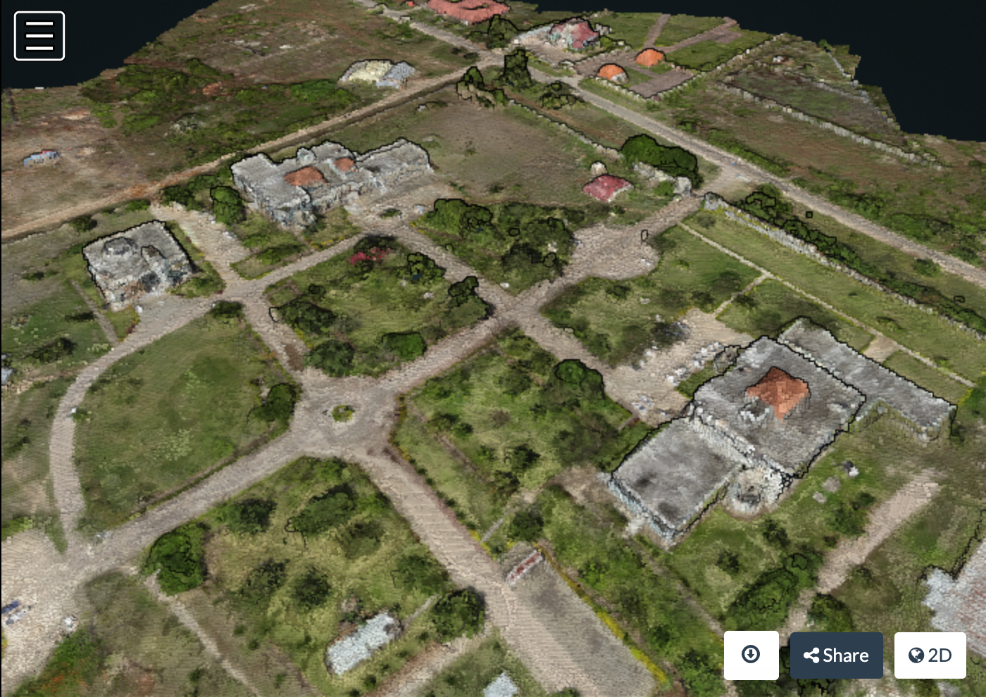
Point cloud over State University Zanzibar, courtesy of Khadija Abdullah Ali
نموذج محكم ثلاثي الأبعاد
odm_texturing/odm_textured_model.obj -- شبكة سطح محكم odm_texturing/odm_textured_model_geo.obj -- شبكة السطح ذات المرجعية الجغرافية والمحكم
يمكنك الوصول إلى سحابة النقاط والشبكات المزخرفة باستخدام MeshLab. افتح MeshLab واختر File: Import Mesh واختر شبكتك المزخرفة من موقع مشابه لما يلي: odm_texturing\odm_textured_model.obj
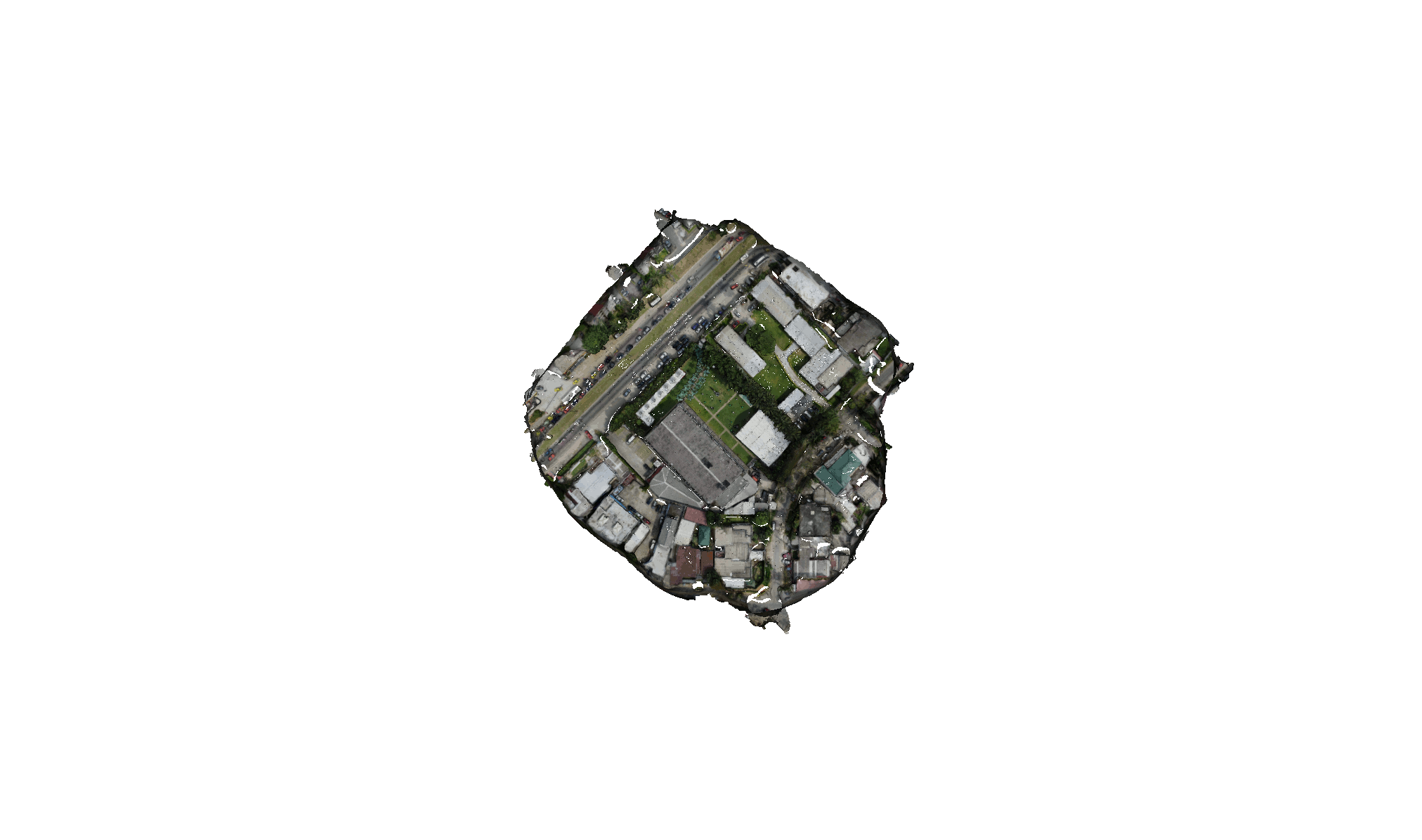
Textured mesh courtesy of OpenDroneMap
Orthophoto
odm_orthophoto/odm_orthphoto.tif -- GeoTIFF Orthophoto. يمكنك استخدامه في QGIS كطبقة نقطية.
odm_orthophoto/odm_orthphoto.original.tif -- The orthophoto in its original un-cropped state.
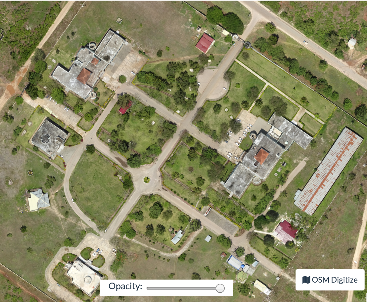
Orthophoto على جامعة ولاية زنجبار ، بإذن من * Khadija Abdullah Ali
DTM/DSM
DTM/DSM سيتم إنشاؤه فقط في حالة استخدام خيارات "--dtm" أو "--dsm". انظر البرنامج التعليمي حول نماذج الارتفاع لمزيد من الخيارات في الإنشاء.
سيتم تخزين البيانات في:
odm_dem/dtm.tif
odm_dem/dsm.tif
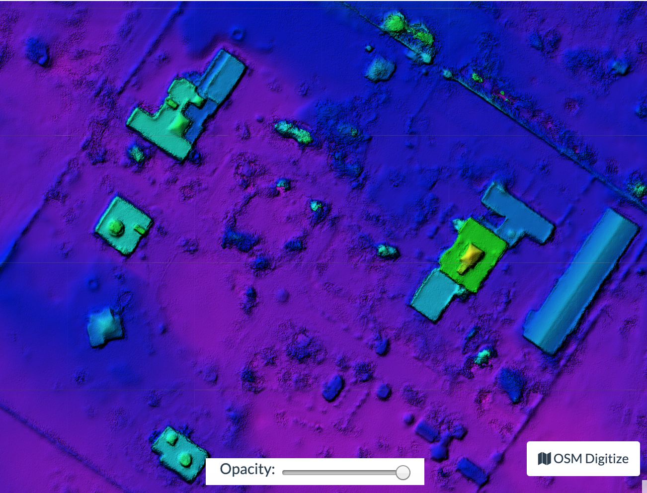
Digital surface model over State University Zanzibar, courtesy of Khadija Abdullah Ali
قائمة بجميع المخرجات
project/
├── images/
│   ├── img-1234.jpg
│   └── ...
├── opensfm/                            # Tie Points and camera positions here in JSON format
│   ├── config.yaml
│   ├── images/
│   ├── masks/
│   ├── gcp_list.txt
│   ├── metadata/
│   ├── features/
│   ├── matches/
│   ├── tracks.csv
│   ├── reconstruction.json
│   ├── reconstruction.meshed.json
│   ├── undistorted/
│   ├── undistorted_tracks.json
│   ├── undistorted_reconstruction.json
│   └── depthmaps/
│      └── merged.ply                   # Dense Point Cloud
├── odm_meshing/
│   ├── odm_mesh.ply                    # A 3D mesh
│   └── odm_meshing_log.txt             # Output of the meshing task. May point out errors.
├── odm_texturing/
│   ├── odm_textured_model.obj          # Textured mesh
│   ├── odm_textured_model_geo.obj      # Georeferenced textured mesh
│   └── texture_N.jpg                   # Associated textured images used by the model
├── odm_georeferencing/
│   ├── odm_georeferenced_model.ply     # A georeferenced dense point cloud
│   ├── odm_georeferenced_model.laz # LAZ format point cloud
│   ├── odm_georeferenced_model.csv     # XYZ format point cloud
│   ├── odm_georeferencing_log.txt      # Georeferencing log
│   └── odm_georeferencing_utm_log.txt  # Log for the extract_utm portion
├── odm_orthophoto/
│   ├── odm_orthophoto.png              # Orthophoto image (no coordinates)
│   ├── odm_orthophoto.tif              # Orthophoto GeoTiff
│   ├── odm_orthophoto_log.txt          # Log file
│   └── gdal_translate_log.txt          # Log for georeferencing the png file
└── odm_dem/
    ├── dsm.tif                     # Digital Surface Model Geotiff - the tops of everything
    └── dtm.tif                     # Digital Terrain Model Geotoff - the ground.
Learn to edit and help improve this page!